What We Offer
We are Professionals in
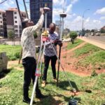
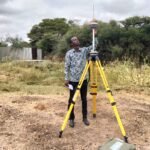
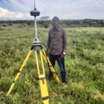
• Planning of sub-division scheme plans • Circulating of the plans in relevant authorities • Facilitating obtaining of consent for sub-division and transfer • Actual ground survey and beaconing • Drawing and approval of mutation forms • Follow up of the mutation for issuance of new numbers from the District Surveyor and subsequent amendment of the registry index map (R.I.M) • Application for registration of the new numbers and printing of new titles for respective new sub-plots or land parcels. • Beacon re-establishment for the damaged ones or a survey search for the unknown beacons • Solving boundary disputes for those cases where both parties are in consensus of a neutral surveyor. Confirmation of land acreage with an accompanying surveyors report after the exercise.
Cadastral surveying is the sub-field of surveying that specializes in the establishment and re- establishment of real property boundaries .it is an important component of the legal creation of properties.it is a survey whose accuracy has been reduced to 0.03mm with all the beacons with respective co-ordinates and lines connecting them with specific bearings. It is a kind of survey characterized in many urban centers in Kenya.
It is a type of survey done to identify and map the contours of the ground and existing features on the surface of the earth or slightly above or below the earth’s surface (i.e. trees, buildings, walkways, manholes, utility poles etc.)
It is a type of survey done for applicants who want power connected to their premises. A surveyor by use of a GPS picks points for the entire route where the power line will pass. Picking all the premises within the road and signing way leave documents for the person whose parcel of land will be affected. This data will be submitted in drawn hard copies to either Kenya Power, Rural Electrification authority or any other power supplying parastatal for design.
This type of survey provides accurate and reliable dimension data throughout either building construction or road construction, process from the base topographical survey, cross sections and ground modelling information to cut and fill calculation, dimensional control to setting out on site and finished as built drawings.
Geographical Information System is a system designed to capture , store,manipulate, analyze, manage and present all types of spatial data doing analog map digitization to soft copy drawings.
Our Gallery
Some of Our Completed Projects
Project: Donyo Sabuk/Komarock Block I/46384 Objective:
Sub-division into 120 portions of 0.04Ha
Status: Complete Title Deed Issued
Project: Kjd/Kaputiei-North
Objective: Sub-division into 16 portions of 0.045Ha
Project: KJD/KAPUTIEI- NORTH/
Objective: Sub-division into three portions of 0.15 Ha, 0.15Ha and 0.33Ha
Status: Complete Titles Issued
Project: Kjd/ Ilkisumet/7700 Objective: Subdivision into 21 portions
